
Tropical Storm Arthur has been upgraded to a hurricane making it the first of the 2014 season. Using a type of microwave radar the Hurricane Hunter aircraft found winds in Arthur of hurricane speeds. The eye of the hurricane is well represented on radar and indications are the storm will strengthen over the course of the day.
Arthur will have about two days to become better organized before the environment becomes hostile for hurricanes. Right now the hurricane shows symmetry north-south-east and west and upper level winds are favorable. This is important for the system to tap into the energy of the warm water that lies beneath it. It is possible that the storm will become a strong category one or weak category two as it moves toward the North Carolina coast by Friday.
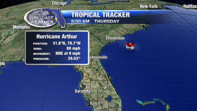
Concern grows that Arthur may get closer to the coast of the Carolinas and hurricane warnings have gone up for the coast of North Carolina to Virginia.

The flow of air drawing moisture into Arthur sits over Florida today and scattered showers are possible anytime.

(0) comments
Welcome to the discussion.
Log In
Keep it Clean. Please avoid obscene, vulgar, lewd, racist or sexually-oriented language.
PLEASE TURN OFF YOUR CAPS LOCK.
Don't Threaten. Threats of harming another person will not be tolerated.
Be Truthful. Don't knowingly lie about anyone or anything.
Be Nice. No racism, sexism or any sort of -ism that is degrading to another person.
Be Proactive. Use the 'Report' link on each comment to let us know of abusive posts.
Share with Us. We'd love to hear eyewitness accounts, the history behind an article.